As I lost a lot of photographs, particularly from the end of the walk in July, and even though I've walked from Norton to Moore along the canal a few times since, I planned to walk from the Top Locks to Moore and then do the blog post before this one... but logistics got in the way. I couldn't cadge a lift to the top locks, so I would have either had to walk from home to the Old Town, most probably along the canal, and then walk back, or, I would have had to walk to the Shopping City and take a bus (a day ticket is £4!) to the old town, and then walk back. I just couldn't face a walk to take a bus to do a walk, when I live less than a third of a mile away from the canal, and I simply didn't want to walk along the canal, and then back the same stretch.
So, I came up with a plan. I'd walk along the canal from our house to the Walton Arms (covering the area I'd lost the photographs for and beyond) and then Beloved should have finished the overtime he was doing, and could come and pick me up, we could both have a drink and a nice lazy afternoon.
As you can probably tell, by the title, and the screenshot from Runkeeper below, things didn't quite go to plan.
Soundtrack: I couldn't get into an audiobook today, tried a radio drama, but it didn't suit the mood, so I stuck music on random and tried not to sing along when other people were about (and there were lots of other people at various parts of the day). I did listen to a full album between the Walton Arms and Grappenhall... It was Islands by Einaudi. Mainly though, I was listening to rock/metal.
Kit: I did have my pacer poles, salomons, a technical fibre sleeveless top, Craghopper trousers, blisterproof socks (seem to have done alright, can only feel one, and it's not fully formed so might still go away), and a pac-a-mac (don't judge me, it's lightweight and kept the rain off and it did rain for a while). No rucksack today, just a crossbody handbag (small) and my camera. I *should* have taken a rucksack and a lot more water than the 1litre I did take, but I bought a drink at the Walton Arms, and at the shops in Lymm, as well as at the pub with tea. Other sustenance was a sandwich, packet of crisps and a banana, followed by a chocolate bar later.
 |
| This is a collage of 4 photographs (badly stitched together, sorry, first attempt) showing the view where I join the Bridgewater Canal from home. |
Where I joined the canal isn't actually the towpath, which is on the opposite side, it's a council run footpath which runs alongside the canal through Norton, but after the next bridge, it stops, where some houses back onto the canal.
The first deviation from the plan, was me not actually going to Preston Brook. I cut the corner!
At the Marina, the tow path stops. The official route is to jump off the canal on the opposite side of the canal to the towpath, (from the next bridge along from the one shown above) and walk along Marina Lane, a single carriageway road with passing places which has no footway and then return to the canal until the footbridge before the motorway bridge.
However, that road isn't the safest for pedestrians (in my opinion, plenty of other people walk dogs down it), and so, I took the slightly safer (believe it or not) footpath across the level crossing!
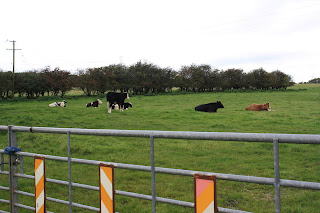
It's a nice little path, although technically, it's a road, to a house just by the level crossing, I've never actually come across a car whilst walking down it yet. It goes past fields of sheep and cows, and is less than a mile from home.
The level crossing only serves around 2 trains each hour (one in each direction) but they can reach in excess of 100mph according to the signs.
Once over the crossing, I
could have taken an even bigger shortcut up some particularly steep steps with no hand rail...
Or one can turn right straight after the level crossing, and join the canal tow path around a third of a mile earlier on. So, I turned right. (Okay, technically, because I went to take a photo of the steep steps, I turned left... ssshhh!)
I walked along the towpath from here to Daresbury labs, passing views of three of the best known local landmarks.
 |
| The Water Tower - Norton |
 |
| Fiddlers Ferry - Widnes/Warrington |
 |
| Daresbury Labs - Daresbury |
and at the very first bench (opposite Daresbury Labs) I sat down and ate my sandwich... in my defence, at this point, I really did think I was only going as far as Walton.
I should mention that there are benches on the towpath, however, they tend to come in clusters. So, there's none between Preston Brook and here, then there's no more until Moore, then it's ages until the next cluster, and so on. Although there are at least two trees that you can sit in if you really need to. However, from my sandwich stop, I kept on until Moore.
 |
| Autumn! |
At the bench you can see in the distance in the Autumnal photo above, I usually leave the towpath and follow the road round to the left to get to the Red Lion... but not today!
 |
| I did have a rest and a drink here though |
I eventually left the towpath at Walton, and stopped at the Walton Arms, as originally planned. I bought a drink, I used the loo, and I phoned home. Beloved's overtime was not going well, I hadn't hit my 10km target... Well, I'll walk a bit further, I suggested, you call me when you're done?
So I left the warm, and cosy armchair of the Walton Arms bar, and headed back to the towpath... to Stockton Heath, where there is a shop on the tow path, aimed at canalboat traffic, but selling chocolate bars, and so I nipped in and bought one. At this point, I had done my 10km, and I could see the London Bridge pub in Stockton Heath, but Beloved hadn't finished work, so I kept walking.
I ate my chocolate bar on the hoof, and didn't stop until Grappenhall.
 |
| I had a brief rest here |
Beloved still hadn't finished, so I kept going...
 |
| The towpath isn't as good along some stretches of the canal as at others... |
 |
| ... and along some stretches, it's just grass! |
 |
| Sorry about the dodgy angle, I slipped and thought I was going in, but I love this section, so the photo stays. It was so pretty. |
 |
| On the opposite side of the canal from the towpath, through private land, seems to have another little offshoot beyond the pretty bridge, but also lots of stern signs saying things like 'no mooring', '24 hour CCTV' and 'dogs roaming', eek! |
 |
| I saw lots of boats, unsurprisingly, but only one was sunk! |
The road bridge you can see in the last photo above? That's the M6. That's the bottom of the Thelwall Viaduct. Thelwall is a very pretty village, well, from the canal towpath, but the noise of the motorway can be heard almost into Lymm!
Finally, between Thelwall and Lymm, Beloved called to say that he had finished work and could come and pick me up... alas, I wasn't handily near to a pub, or to the main road. So, having checked the map, we agreed to meet at Lymm Dam, which meant carrying on to Lymm, coming off the canal, walking through the village and up along Barlow Brier.
 |
| I left the canal at this bridge in Lymm |
 |
| Walked through the village centre, past Lymm Cross... |
 |
| ... The Dingle ... |
 |
| ... and the Dinosaur footprint ... |
 |
| ... which I couldn't actually see! ... |
 |
| Along the footpath along side the brier |
 |
| up the steepest stairs ever... (okay, maybe not the steepest ever, but I was tired and achey by this point) |
 |
| through an ornate archway |
 |
| and across the A56... to Lymm Dam |
Where I found a bench next to a large layby, with a view of the dam, and waited all of 5 minutes for Beloved to come and rescue me (think he left home while I was still on the canal). We went to the pub for tea, (Beloved having brought me clean clothes to change into in the loos, I do have some standards you know) and then home for a well earned shower!


 The level crossing only serves around 2 trains each hour (one in each direction) but they can reach in excess of 100mph according to the signs.


 I walked along the towpath from here to Daresbury labs, passing views of three of the best known local landmarks.


Comments
Post a Comment